The library is now hosting two exhibits by David Chandler and Stanley Sklar.
This is the last week to see two separate exhibits linked by themes of geography and history at the Côte-Saint-Luc Library. These displays are produced by two local residents—an antique map collector David Chandler and an artist Stanley Sklar.
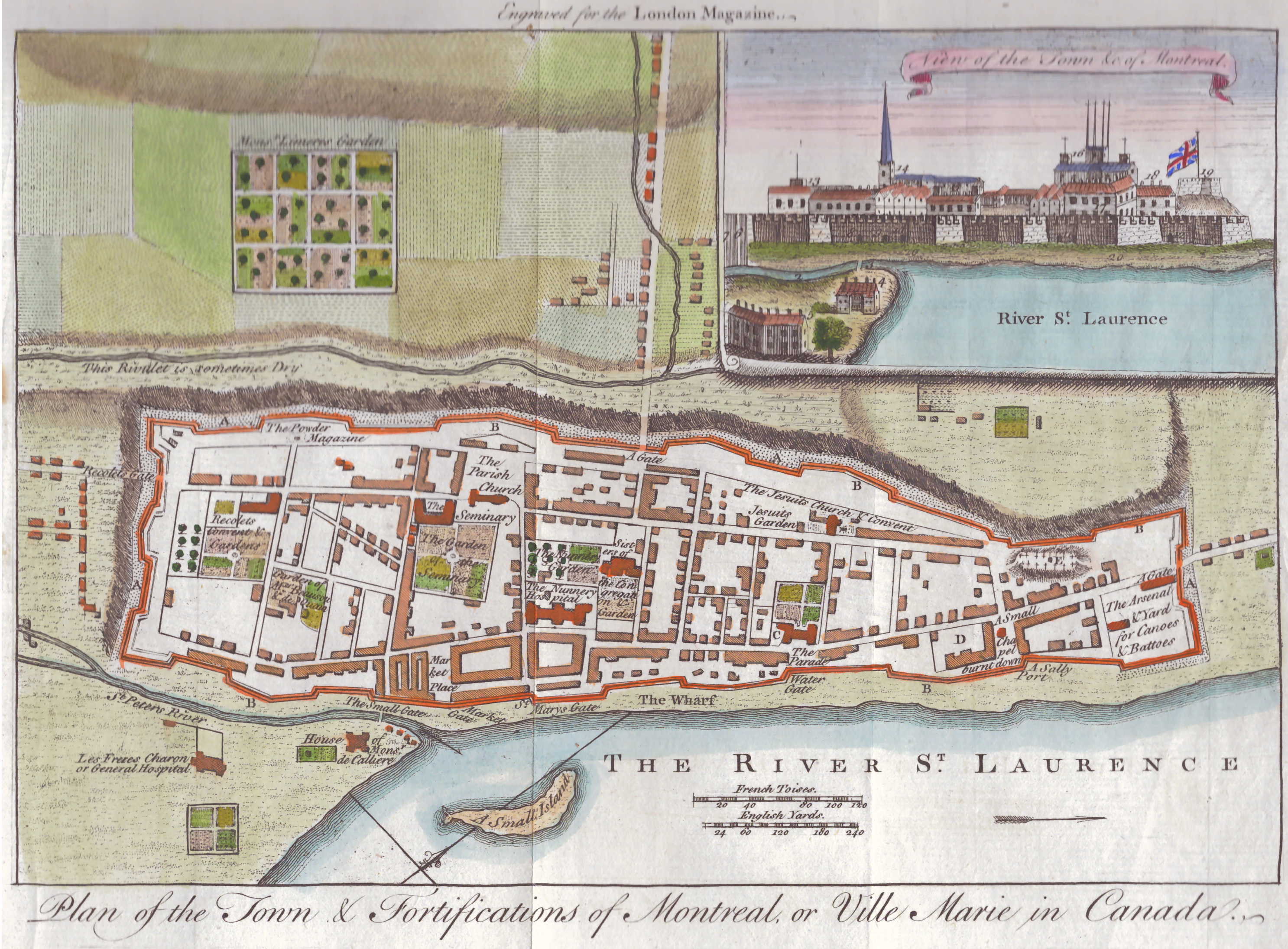
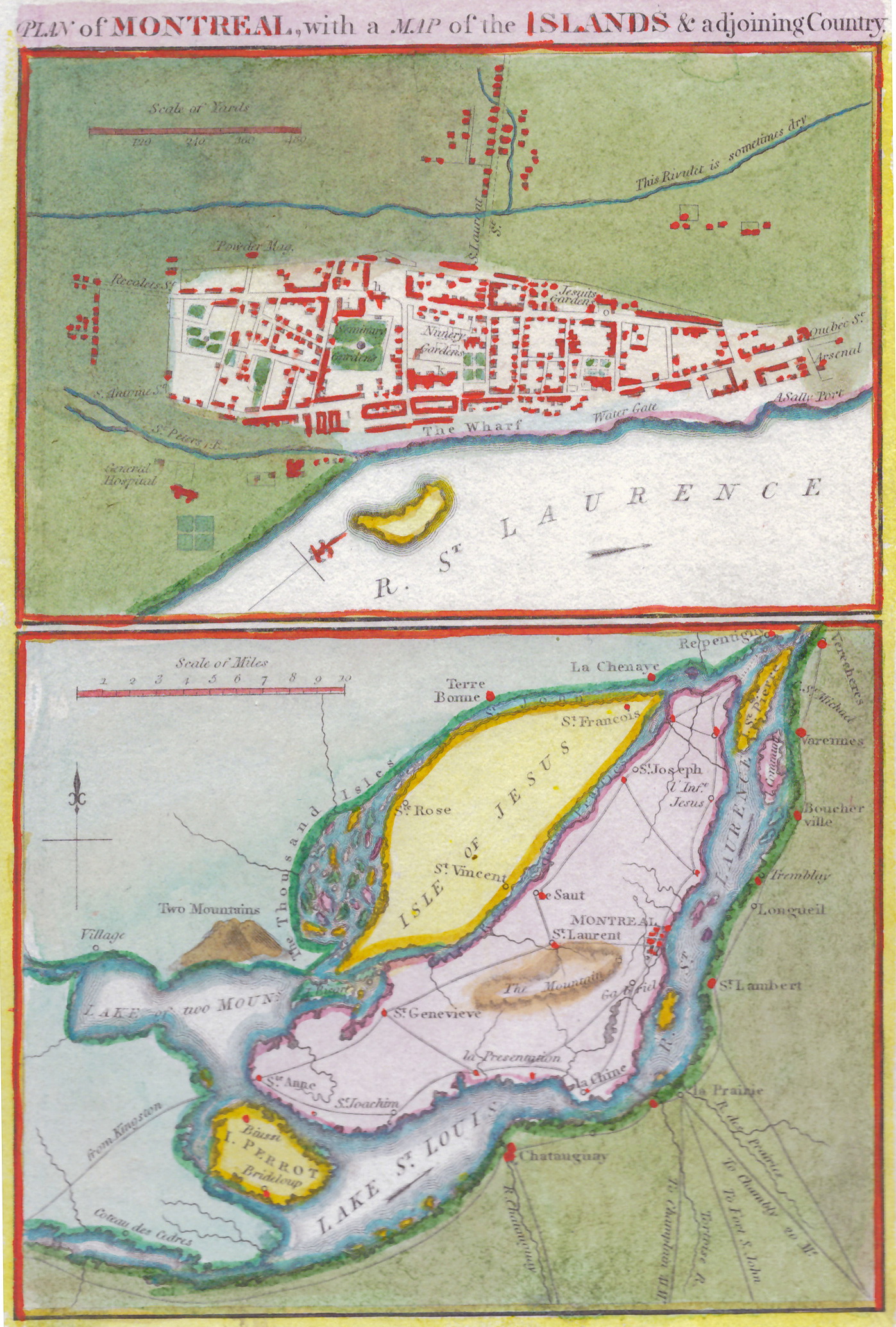
Antique Maps from the Holy Land to New France, by David Chandler, offers a unique opportunity to examine original limited-edition maps. This exhibit features 56 maps and is divided into two parts: 17 maps feature the Holy Land and its surrounding area, and the remaining maps portray early North American and Montreal geography.
A helpful catalogue is available that offers valuable pointers that illuminate the information the maps contain. The maps are beautiful to look at and it is easy to appreciate the dedication and patience cartographers expended in producing them.
“I am a visual person,” said Chandler, a retired high school teacher whose love for maps began in childhood while living in the Maritimes. Chandler mentioned he started collecting antique maps in the early 1980s, and now owns thousands. “To see the big picture you need a paper map,” he said.
Chandler explained that the cartographers of antique maps usually never visited the areas they drew. Instead, they relied on reports from travellers and ship captains and used existing maps, along with a good measure of their imagination.
My attention was drawn to the La terra de Hochelaga map, which was created by an Italian cartographer in the 16th century when “[Cartier] went back home and nobody in France gave a sweet damn about him coming to New France, not even the king … and he could not get published at all,” said Chandler. The map was eventually published in an Italian book and shows Mont Real as the location for Mount Royal.
Chandler pointed out that some antique maps were deliberately embellished when they were created, referring to the Cartes du Lacs du Canada map as an example. He said it is suspected that the explorer, Pierre François Xavier de Charlevoix, “realized that he had not named anything after his benefactors back in France … so he created four or five little islands in Lake Superior that can be seen in the map of 1744.” Chandler said because cartographers copied from one another, these islands remained on maps until the early 19th century.
The exhibit can be viewed in the Community Art Space section of the library until Jan. 31.
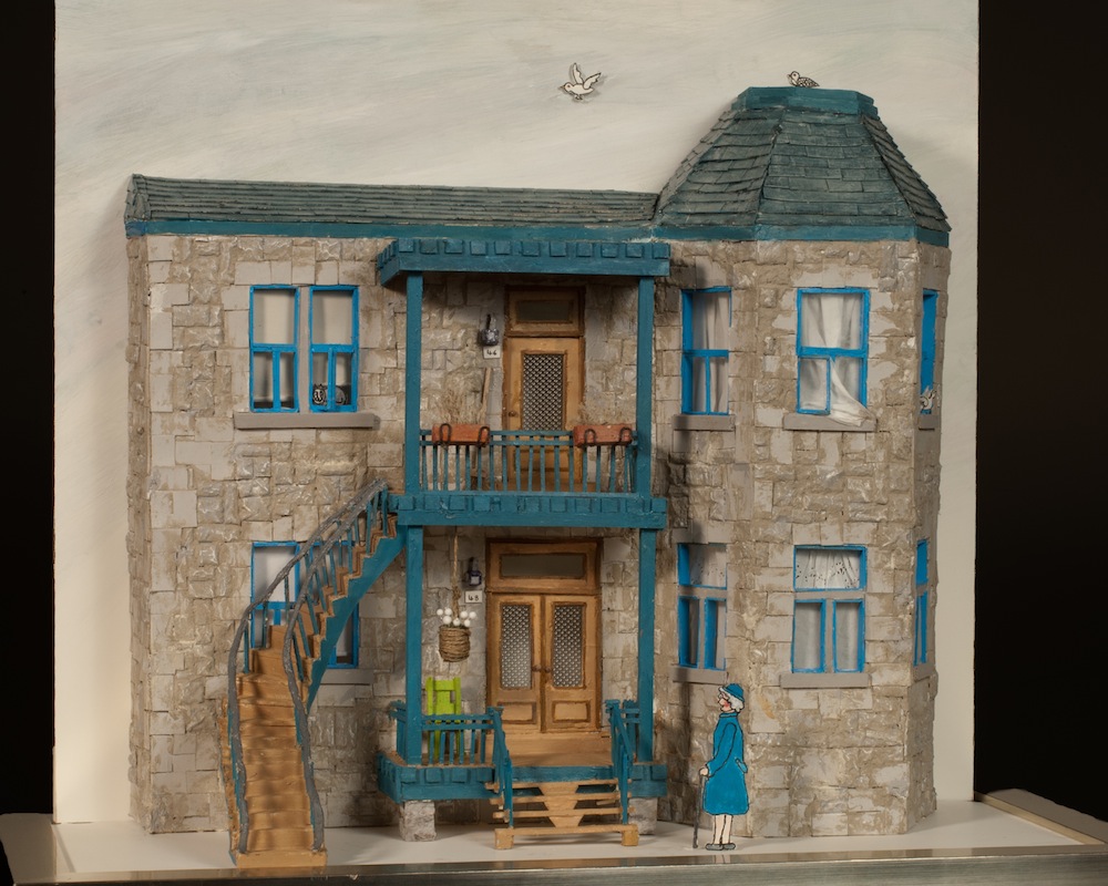
Stanley Sklar’s art exhibit offers another dimension on the theme of history and geography that is guaranteed to evoke memories of home. This exhibit contains miniature replicas of buildings such as houses, famous restaurants, a food stall and a synagogue that are transformed by Sklar’s meticulous attention to the details he added to each scene.
Sklar, an award-winning designer of women’s eveningwear, studied draping at the Fashion Institute of Technology in New York, where he discovered “working on a mannequin with fabric and pinning, creating and shaping—that was my love,” said Sklar. In retirement, Sklar combined this passion with his skills as a designer and a creator to develop a new artistic expression that is three-dimensional.
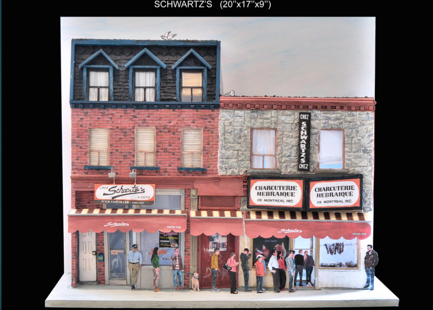
The fusion of the many little details that come together in the miniatures make the pleasure the occupants derive from their living space almost palpable to the viewer, while the busy scenes communicate the existing community spirit.
To transform these structures into homes Sklar said he replicated what he saw and took a multitude of pictures. In addition, he said he also spent time at the sites observing life in the neighbourhoods.
The homes displayed are encased in clear boxes and can be purchased. The exhibit is located in the fiction section of the library and will continue until an end date is announced.
The Côte-Saint-Luc library is located at 5851 Cavendish Boul.


